

This year, the field group (GSDN) of the GPS Laboratory (LGPS), based on the Global Navigation Satellite Systems (GNSS) method, carried out planned field measurements of GNSS network sites in the Naryn and Issyk-Kul regions of Kyrgyzstan. Repeated surveys of the same GNSS sites in the study area make it possible to determine the high-precision position of the sites at the time of measurement and track the long-term rate of its displacement to solve fundamental geodynamic problems, as well as to assess the danger of living the population and other objects.
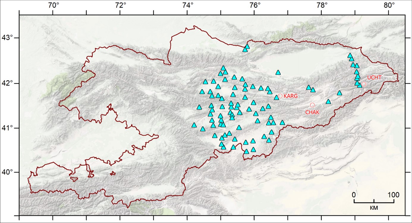
From May to September 2023, LGPS employees traditionally carried out two campaigns (KGS23a from 05/31/2023 to 06/30/2023; KGS23b from 08/09/2023 to 09/08/2023) to measure regional sites in the eastern part of Kyrgyzstan (Fig. 1).
|
Figure 1 - Regional marks where GNSS work was carried out in 2023: triangular markers - re-measured this year (89); round markers are planned but not measured sites due to the impossibility of access to them (3). |
According to the decision of the administration of the RS RAS, from March 2022, only 3 brigades can participate in field GNSS campaigns. Each team includes an operator and driver of a ZIL-131 or GAZ-33088 vehicle. During the month, each team measures 14-15 sites, 36 hours are allocated to measure each site. At the same time, the vehicle mileage during one campaign was 1688-2133 km. The average vehicle mileage between observation sites was 126 km.
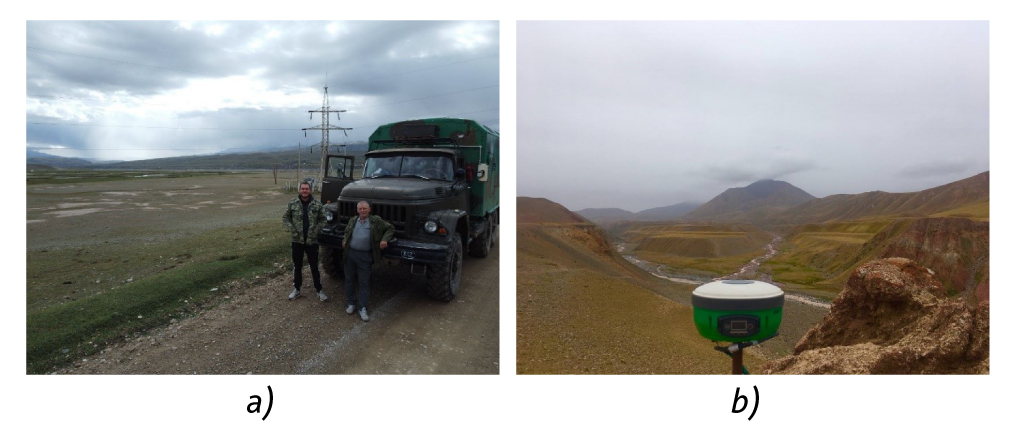
Since 2020, GSDN employees have been carrying out GNSS measurements with Russian-made MP-8 receivers, capable of recording signals from 4 satellite constellations: GPS, GLONASS, Beidou and SBAS (Fig. 2).
|
Figure 2 – Fragments of field GNSS work in 2023: a) The field team moves between regional GNSS measurement points; b) Measurement at a GNSS point with an MP-8 receiver with a rod support. |


